


jl1global .com's Store
easyid.live/biz/jl1global • Verified Store
Scan to open official EasyID digital store and view live catalog.
Share jl1global .com's Store
Share this store link with your friends and customers
jl1global .com's Store
Open Now • Open 24/7Verified Merchant
EasyID Certified Seller
Fast 24h Packing
Direct courier dispatch
Zero Escrow Direct
Direct merchant settlement
Store Listings (6)
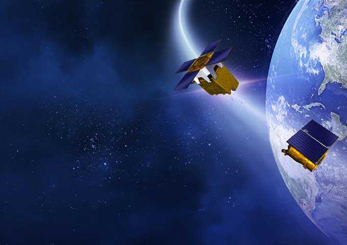
Satellite Remote Sensing
[a]https%3A%2F%2Fwww.jl1global.com%2Fproducts%2Fsatellite-remote-sensing%2F[/a] <br>#aerial #satellite #services <br>Satellite Remote Sensing <br>Remote sensing is a non-contact, long-distance detection technology. Relying on the unique global data set of JL1, using our big data intelligence tool to understand the changes taking place in the areas you are most concerned about, and help you make decisions faster and better. <br> <br>REMOTE SENSING SATELLITE SYSTEMS-DETECTING THE EARTH <br> <br>What is Remote Sensing <br>optical remote sensing satellite is a comprehensive earth observation technology developed in the 1960s. It generally refers to all non-contact long-distance detection, including detection of electromagnetic fields, force fields and mechanical waves (sound waves and seismic waves). <br> <br>satellite remote sensing data <br>What is a Remote Sensing System <br>The remote sensing system mainly includes remote sensing information source, remote sensing information acquisition, remote sensing information processing and remote sensing information application. <br> <br>EXPLORE REMOTE SENSING SATELLITE MARKETS <br>high resolution remote sensing satellites list <br>Urban Planning <br>The application of high-resolution remote sensing data to urban planning analysis is one of the main aspects of remote sensing applications, such as: <br> <br>Dynamic monitoring of urban construction <br> <br>Extraction of urban road network <br> <br>Urban expansion monitoring <br> <br>Urban environmental monitoring and assessment <br> <br>remote sensing in environment <br>Environment <br>Remote sensing image has always been a powerful tool for environmental monitoring. Some of the feasible applications are: <br> <br>Environmental impact assessment for a wide range of projects (natural resources exploitation, infrastructure development, etc) <br> <br>River/Lake water bodies monitoring <br> <br>Desertification processes monitoring and mitigation activities <br> <br>Erosive processes analysis, restoration techniques planning and implementation <br> <br>agriculture satellite data <br>Agriculture <br>There is able to provide data for monitoring, mapping and deriving biophysical parameters and state of agricultural lands. Some of the possible applications are: <br> <br>Crop spatial distribution <br>Crop condition monitoring <br>Agricultural reservation supervision <br>Agricultural disaster monitoring <br> <br>Chang Guang Satellite Technology Co., Ltd. is a satellite data companies, we provide satellite china, remote sensing satellite, satellite based remote sensing, aerial satellite services, etc. For more information about types of remote sensing satellites and satellite remote sensing technology, please feel free to contact us!
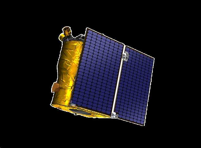
SATELLITE PRODUCTS
[a]https%3A%2F%2Fwww.jl1global.com%2Fproducts%2Fsatellite-products%2F[/a] <br>#satellite #accessories <br>SATELLITE PRODUCTS <br>Jilin 1 satellite constellation is the core project of CGSTL. It is composed of 138 high-performance optical remote sensing satellites covering high resolution, large width, video, and multi-spectrum. <br> <br>1m-resolution GF satellite accessories <br>1m-resolution SP (Video) Satellites <br>5m Resolution Satellite Image <br>Global Navigation Satellite System <br> <br>FEATURES OF satcom products <br>1 <br>High resolution, large width, video, and multi-spectrum. <br> <br>There are many commercial satellite manufacturers, but we are one of the best choices for you.

MARINE REMOTE SENSING
[a]https%3A%2F%2Fwww.jl1global.com%2Fproducts%2Focean-remote-sensing.html[/a] <br>#ocean #color #remote #sensing <br>MARINE REMOTE SENSING <br>Ocean colour remote sensing refers to remote sensing that takes the ocean and coastal zone as the monitoring and research object, including remote sensing oceanography, biological oceanography and chemical ocean remote sensing. Ocean remote sensing uses sensors to carry out long-distance non-contact observation of the ocean to obtain images or data of the marine landscape and marine elements. <br> <br>For more about satellite data system and Jilin 1 satellite, please feel free to contact us!
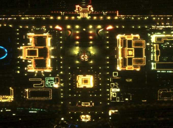
NIGHT SATELLITE IMAGE
[a]https%3A%2F%2Fwww.jl1global.com%2Fproducts%2Fnight-satellite-image%2F[/a] <br>#night #time #data <br>The SP and GF03C satellites of JL1 constellection can conduct fast shooting with high-resolutions and multispectrums at night, which can reflect human activities through luminous data at night. <br> <br>FEATURES OF NIGHT LIGHT SATELLITE IMAGES <br>1 <br>High spatial resolution. <br> <br>2 <br>Multiple spectral bands and flexible data acquisition. <br> <br>Chang Guang Satellite Technology Co., Ltd. is a satellite company, we provide Jilin satellite, satellite view of earth at night, night time data, live satellite view of earth at night, night time light data, satellite data products, etc. For more information, please feel free to contact us!
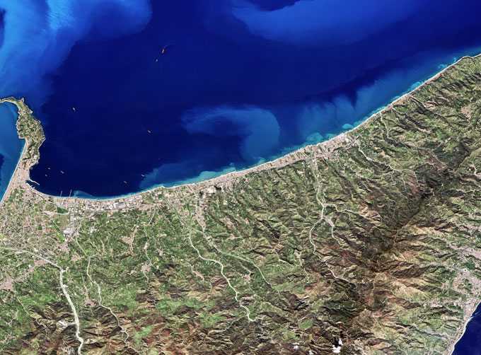
MULTISPECTRAL IMAGES IN REMOTE SENSING
[a]https%3A%2F%2Fwww.jl1global.com%2Fproducts%2Fmultispectral-remote-sensing.html[/a] <br>#multispectral #data #remote #sensing <br>Multispectral remote sensing refers to the multispectral data remote sensing technology that divides the electromagnetic wave radiated by ground objects into several narrow spectral bands and obtains the information of the same target in different bands at the same time by photographing or scanning. <br> <br>Chang Guang Satellite Technology Co., Ltd. is a satellite company, we provide satellite china, multispectral and hyperspectral remote sensing, multispectral remote sensing, hyperspectral and multispectral remote sensing, multi spectral remote sensing, satellite data products, etc. For more information about multispectral remote sensing applications, please feel free to contact us!
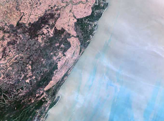
MULTI SPECTRAL IMAGERY
[a]https%3A%2F%2Fwww.jl1global.com%2Fproducts%2Fmultispectral-image-data%2F[/a] <br>#multispectral #image <br>The GP satellites of JL1 constellection have 26 spectral channels, covering optical remote sensing data from visible light to long wave infrared. <br> <br>FEATURES OF MULTI SPECTRAL IMAGERY <br>1 <br>Ultra wide width, ultra-high radiation quality. <br> <br>2 <br>Ultra-high information resolution. <br> <br>Chang Guang Satellite Technology Co., Ltd. is a satellite company, we provide multispectral and hyperspectral, multispectral image, hyperspectral and multispectral, hyperspectral and multispectral imaging, multispectral hyperspectral, multispectral image data, multispectral and hyperspectral imaging, aerial satellite services, etc. For more information, please feel free to contact us!
About jl1global .com's Store
No description provided.
0.0
Customer Reviews
See what others are saying about jl1global .com's Store. We verify purchases to ensure reviews are genuine.
No reviews yet for this store.